By Chad de Alva
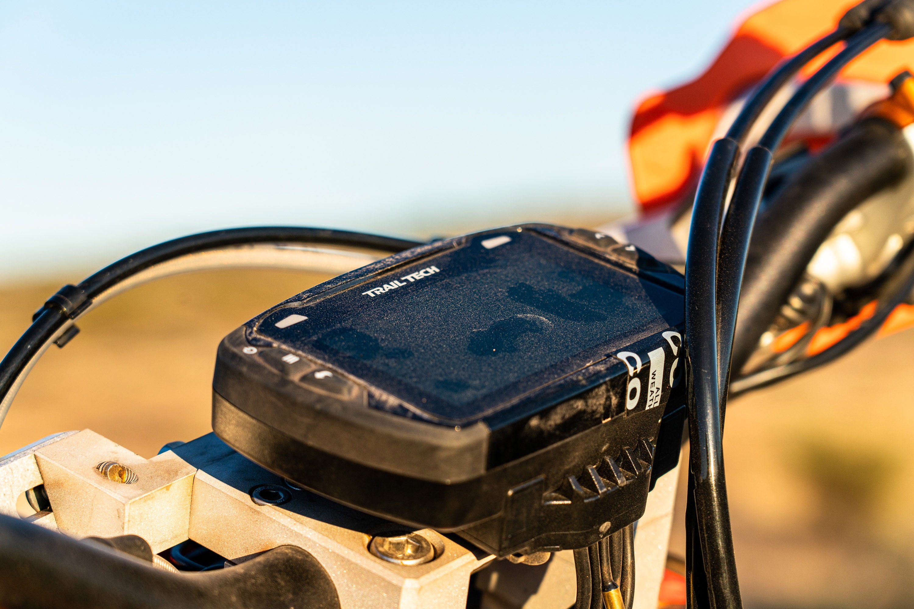
Trail Tech’s Voyager Pro (VP) is unique in the world of motorcycle GPS units. The unit has been on sale for several years, yet it continues to offer a feature set that can’t be found anywhere else. The Voyager Pro can accept telemetry from a number of different sensors or its built-in GPS, and that makes the unit a great motorcycle computer. The GPS also means that the Voyager Pro is able to perform many common GPS tasks, like mapping, navigating, and recording tracks and waypoints. Bluetooth connectivity, buddy tracking, and a number of other features make the unit appealing to all sorts of riders, many of whom appreciate only having one device on their bike that does everything they need. Since the Voyager Pro’s launch, Trail Tech has continued to develop the device’s software, and their latest firmware opens the door to a world of custom, user created maps.
The Voyager Pro’s latest firmware allows the unit to process GEOPDFs and MBTiles, which means that users can source or create the exact maps they want and load them on to the VP for a next level navigation experience. The potential here is impressive, as users can combine all sorts of GIS information on their maps. For example: let’s say you’re planning on riding a complete BDR. You want the basics like a satellite imagery base layer, your route, and all of your stops. Maybe you want to do some extra exploring while you’re on the trip, so you add in the Forest Service’s MVUM layer for extra roads and trails to explore. What about a hiking trails layer for that down day on the route? Need to stay connected to reality? Add in a cell coverage layer. Want to navigate off of USGS quads? Download them as GEOPDFs, and you can do exactly that. The short answer is that almost any sort of map can be created and loaded onto the Voyager Pro. Here’s how to do it.
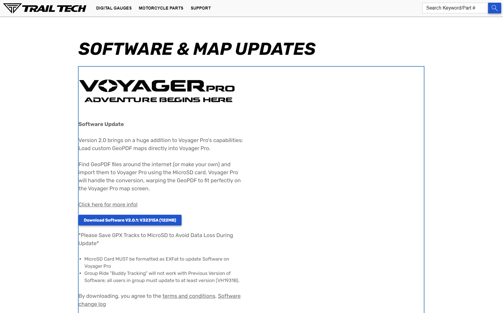
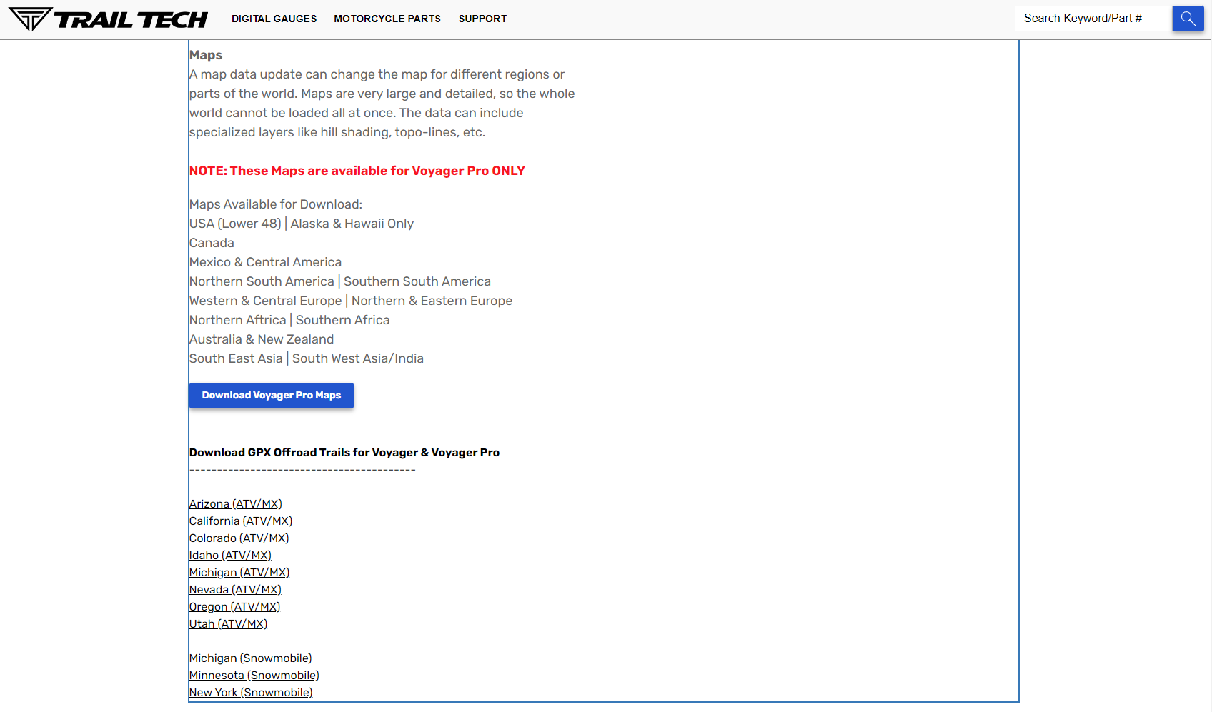
Step one is to update the Voyager Pro to the latest firmware. To do this you’ll need a computer with an internet connection, a micro SD card reader, and a micro SD card. I recommend a 64GB card. Open a browser and head to Trail Tech’s Software and Map Updates page https://www.trailtech.net/en-us/software/, where you’ll see a blue box to download Software. While you’re here, grab the latest base map update too. If you scroll down a little further on this page, you’ll also find GPX files with trails for a dozen-odd states.
Step two is to copy the files you downloaded onto your SD Card. I’d recommend placing the map update and firmware in a folder named something to the effect of “Update <date loaded>” so you have an easy way to reference when you last updated.
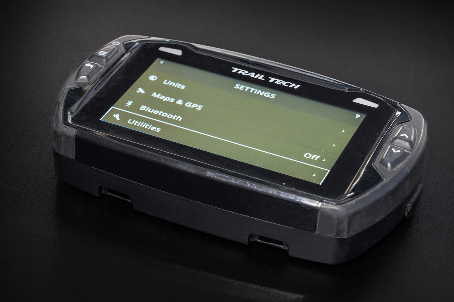
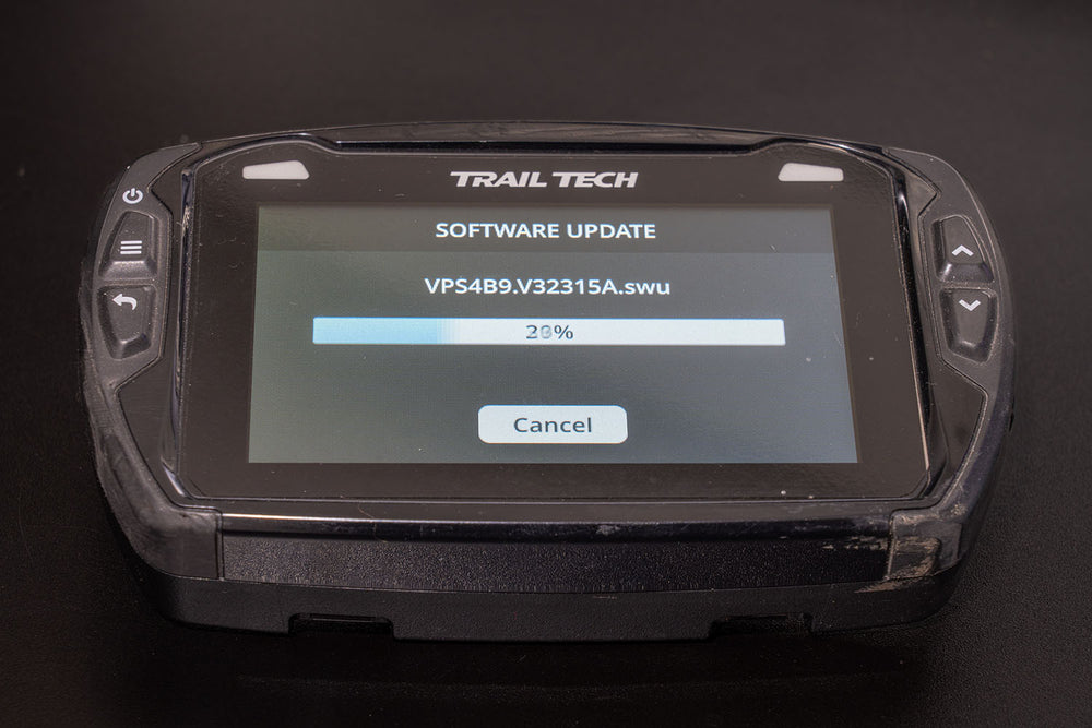
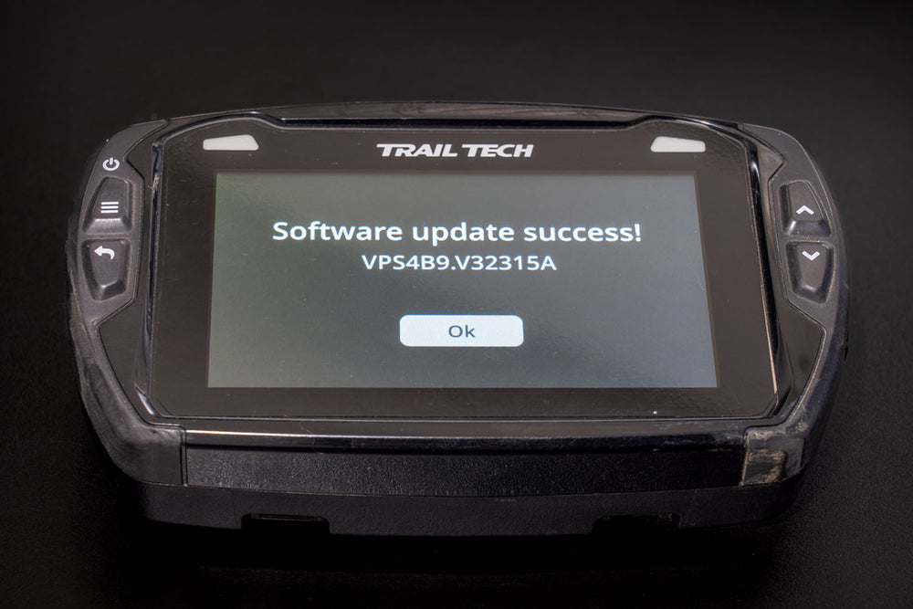
Step three is to install the updates onto your Voyager Pro. On your VP, hit the Menu Button (top left button). Tap Utilities. Tap Software Update. Here you can update the base map and firmware.
Now that your Voyager Pro is fully updated, it’s time to nerd out on making or sourcing custom maps. The two file types the Voyager Pro can process are GEOPDFs and MBTiles. The Trail Tech website has a page where you can find GEOPDFs, and many federal land managers have GEOPDFs available for download on their websites. USGS Maps are available here. When it comes to sourcing maps, google is your friend, as are Facebook Groups, forums, and local clubs.
For creating your own maps, there are a number of desktop and browser-based programs out there that can create GEOPDFs and MBTiles ranging from open-source GIS software (like QGIS) to browser-based mapping programs (like CalTopo).
The following directions will cover how to make MBTiles using CalTopo.
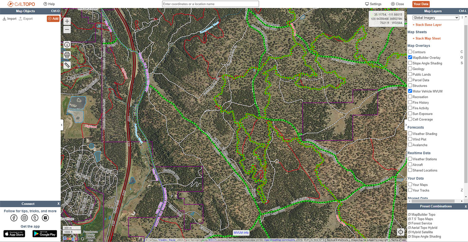
To create and export MBTiles from CalTopo, you’ll need to create an account and spend $50 / year on a Pro Subscription. Once you have your Pro account set up, navigate to wherever in the world you want to make a custom map. On the right side of the CalTopo interface you’ll see all of the map layers that you can stack to create your custom map. In this example, we’re combining Global Imagery (Aerial Imagery), MapBuilder Overlay, and Motor Vehicle MUVM to show roads and legal motorized trails around Flagstaff, AZ.
If you want to add your own routes or waypoints, you can add Map Objects to your map using the pane on the left-hand side of the window.
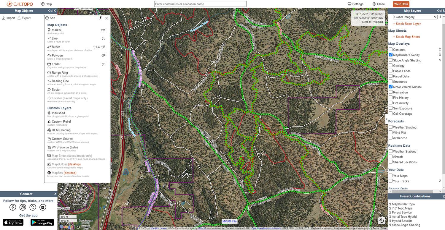
When your map is fully built, it’s time to export it. Look for the PRINT BUTTON on the left-hand side of the map window. In the Format drop-down select MBTiles File. I would recommend selecting the highest level of zoom to give you the most information possible. In the map window you’ll notice a red shaded box, which indicates where CalTopo will create MBTiles. Use the red dot in the center of the shaded area to position the box over the map as needed. If you want to capture a larger area, zoom out and hit the START OVER button to reload the download region. Don’t try to download an entire state in one shot – CalTopo can only create 8,000 MBTiles in one export. If you’re trying to make maps for a large area or for something like an entire BDR, you’ll need to do multiple exports. CalTopo names each export “maps.mbtiles” so rename each export to something meaningful once it finishes downloading.


To get the MBTiles (the workflow for GEOPDFs is the same) on your Voyager Pro, copy the files onto your SD Card. On the Voyager Pro, toggle over to the map screen. Tap the THREE VERTICAL DOTS icon in the bottom left of the screen. Tap OPTIONS. Tap CUSTOM MAPS. Tap IMPORT A NEW FILE. Navigate to the MBTiles files you want to load on your SD Card. Tap on the file to load it. The Voyager Pro will process the file, and let you know when it’s done. By default, the file is turned on. If you need to manage which files are displayed, go to OPTIONS >> CUSTOM MAPS >> MAP FILES. Here you can toggle visibility and other options. Now you’ve got custom maps on your Voyager Pro.
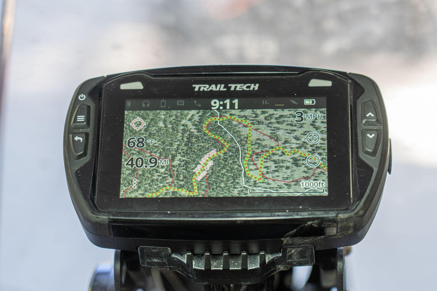
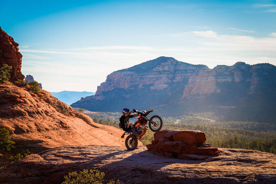
Trail Tech’s Voyager Pro has been my go-to dirt bike / snow bike GPS for years because it combines essential motorcycle telemetry with a GPS in a single unit that fits neatly on my dirt bikes. When snowbiking, I can have a custom map with satellite imagery and contour lines which helps me pick my way through the trees and judge slope aspect on where I’m planning to ride. I can also keep an eye on my engine temp, thanks to the customizable data fields on the Voyager Pro’s map screen. When riding on dirt, I can make maps like in the above example, where I’ve again got a satellite base map, and MUVM and roads and trails loaded. I can add my own tracks / routes / and waypoints as needed, and I can configure the map to show trip distance. Icing on the cake is the Buddy Tracking, which works over any map and lets me keep an eye on where the other VP-equipped riders in my group are located.

The Voyager Pro is a versatile device, and with a little time on the computer, it can be a very powerful mapping tool.
For more information on the Voyager Pro visit www.Trailtech.net. If you’re interested in purchasing a Trail tech Voyager Pro go to the Upshift Store.
This story was originally published in Issue 82